Thunderstorm cloud anvil
1344×768 · AVIF · CC BY 4.0

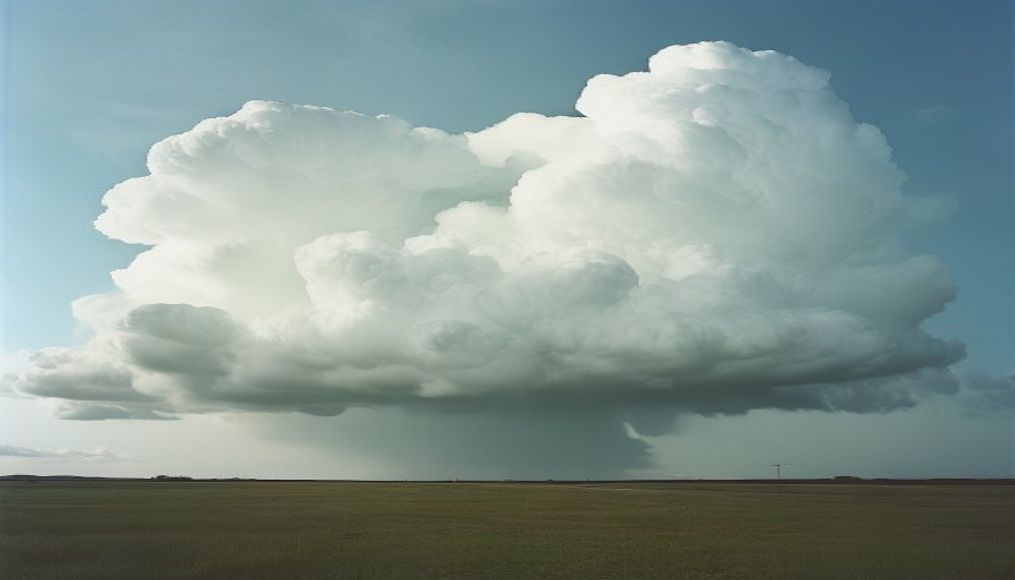
Cumulonimbus clouds develop an anvil shape at the top when they reach the tropopause, signaling severe thunderstorms.
About this subject
The most powerful thunderstorm clouds, cumulonimbus, are known for their flattened anvil-shaped top. This structure forms when the storm's updraft reaches the tropopause, the boundary between the troposphere and stratosphere. Because the air there is more stable and cold, the cloud cannot rise further and spreads out horizontally, creating the anvil. This feature is one of the clearest visual indicators of a mature and potentially dangerous storm, with risks of hail, strong winds, and tornadoes.
The anvil can extend for tens of kilometers downwind, often appearing to move ahead of the storm. Its edge is usually smooth and well-defined, while the underside may feature mammatus, pouch-like protrusions that indicate intense turbulence. The grayish or white color of the anvil contrasts with the dark, threatening base of the cloud, which is typically associated with heavy rainfall.
In Brazil, these formations are common in summer, especially in the South and Southeast regions, where heat and humidity favor convective storms. The anvil is a sign that the storm has reached its maximum development stage. For aircraft, flying over the anvil is dangerous due to turbulence and hail; pilots are trained to avoid it. Understanding this phenomenon has helped improve severe weather forecasts and public warnings.
Frequently Asked Questions
What does a cloud with an anvil-shaped top mean?
It indicates the storm has reached the tropopause and is mature, potentially producing hail, strong winds, and tornadoes. It signifies a severe thunderstorm.
Why is the anvil dangerous for aviation?
Because it contains severe turbulence, hail, and intense updrafts and downdrafts. Pilots avoid flying over or near it.
Are anvil clouds common in Brazil?
Yes, especially in summer in the South and Southeast regions, due to heat and humidity that favor convective storms.
Direct URL
https://pub-c7d6a6ea828543ac903a74a341ccb2e1.r2.dev/imagens/thunderstorm-cloud-anvil-magazine-editorial-p0.avifHow to credit
Include a visible link back to UtilizAí. Copy one of the snippets below:
<a href="https://xn--utiliza-eza.com/en/midia/imagens/thunderstorm-cloud-anvil-magazine-editorial-p0">Thunderstorm cloud anvil</a> by <a href="https://xn--utiliza-eza.com">UtilizAí</a>, licensed under <a href="https://creativecommons.org/licenses/by/4.0/">CC BY 4.0</a>.
[Thunderstorm cloud anvil](https://xn--utiliza-eza.com/en/midia/imagens/thunderstorm-cloud-anvil-magazine-editorial-p0) by [UtilizAí](https://xn--utiliza-eza.com), CC BY 4.0
License: CC-BY-4.0