Mammatus cloud bottoms
1344×768 · AVIF · CC BY 4.0
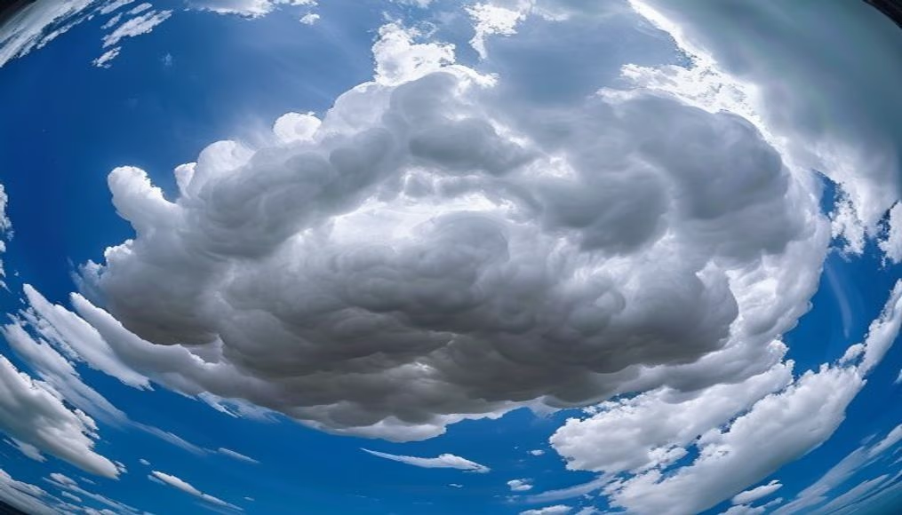
Mammatus clouds are rare and striking atmospheric formations characterized by rounded pouches hanging from the base of clouds, often associated with severe thunderstorms.
About this subject
Mammatus clouds (from Latin mamma, meaning 'udder' or 'breast') are unusual atmospheric formations distinguished by rounded, pouch-like protrusions hanging from the underside of a cloud, most often a cumulonimbus. They signal strong atmospheric instability and are frequently observed after or during severe storms, such as those producing tornadoes, hail, or heavy rain. Contrary to popular belief, mammatus are not a harbinger of bad weather but rather a consequence of descending motions of cold, moist air in regions where the parent cloud is dissipating.
These formations can span hundreds of square kilometers and occur at altitudes between 500 meters and 2 kilometers above ground. Scientists explain that the pouches form when saturated, cold air sinks, creating water droplets or ice crystals that rapidly evaporate at the edges, giving the bubbly appearance. Sunlight striking the clouds enhances the contrast between illuminated and shaded areas, producing a dramatic, three-dimensional look.
Geographically, mammatus are most common over the Great Plains of the United States, particularly in Tornado Alley, but can occur anywhere deep convection develops. In Brazil, they are less frequent but have been recorded in states like São Paulo, Rio Grande do Sul, and Mato Grosso do Sul after summer storms. Their color ranges from white to dark gray, depending on droplet thickness and lighting.
Interestingly, despite their menacing look, mammatus clouds are harmless and indicate the storm is weakening. For photographers and amateur meteorologists, they represent one of the most beautiful and photogenic spectacles in nature.
Frequently Asked Questions
Do mammatus clouds indicate an approaching tornado?
No. They typically appear after the storm has passed or is weakening. Although associated with severe thunderstorms, mammatus are not a direct precursor to tornadoes.
Where are mammatus clouds most commonly seen?
They are most frequent over the Great Plains of the United States, especially in Tornado Alley, but can occur anywhere deep convection develops, including Brazil.
What is the typical altitude of mammatus formations?
They form between 500 meters and 2 kilometers above the ground, below the base of the parent cloud.
Direct URL
https://pub-c7d6a6ea828543ac903a74a341ccb2e1.r2.dev/imagens/mammatus-cloud-bottoms-fish-eye-wide-angle-p1.avifHow to credit
Include a visible link back to UtilizAí. Copy one of the snippets below:
<a href="https://xn--utiliza-eza.com/en/midia/imagens/mammatus-cloud-bottoms-fish-eye-wide-angle-p1">Mammatus cloud bottoms</a> by <a href="https://xn--utiliza-eza.com">UtilizAí</a>, licensed under <a href="https://creativecommons.org/licenses/by/4.0/">CC BY 4.0</a>.
[Mammatus cloud bottoms](https://xn--utiliza-eza.com/en/midia/imagens/mammatus-cloud-bottoms-fish-eye-wide-angle-p1) by [UtilizAí](https://xn--utiliza-eza.com), CC BY 4.0
License: CC-BY-4.0