Brazilian highway BR-101 stretching toward horizon with cargo trucks at golden hour
1344×768 · AVIF · CC BY 4.0
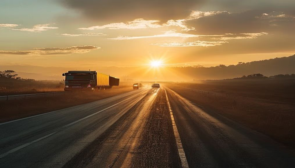
BR-101, Brazil's longest north-south highway, runs along the coast, connecting state borders and driving cargo transport.
About this subject
BR-101 is Brazil's longest north-south highway, stretching approximately 4,800 km from Touros in Rio Grande do Norte to São José do Norte in Rio Grande do Sul. Known as the Translitorânea Highway, it runs along much of the Brazilian coast, crossing 12 states and major cities like Salvador, Vitória, Rio de Janeiro, and Florianópolis. Construction began in the 1940s and was completed in stages, with sections modernized in the 2000s to handle the growing flow of cargo trucks.
The stretch between Rio de Janeiro and Santos is one of the busiest, funneling industrial and agricultural production from the Southeast and South to ports. Trucks loaded with grains, ore, containers, and manufactured goods travel daily, often in convoys stretching for miles. The highway also faces logistical bottlenecks, such as the Petrópolis mountain range and the Rio-Niterói bridge, where heavy traffic requires constant maintenance.
Beyond cargo transport, BR-101 is important for tourism, linking famous beaches like Porto de Galinhas, Guarapari, and Bombinhas. However, the pavement often passes near traditional communities and Atlantic Forest areas, sparking debates about environmental impacts. In 2022, the federal government announced investments in duplication and improvements on critical stretches to reduce accidents and increase logistical efficiency.
Interestingly, BR-101 crosses the Tropic of Capricorn near Ubatuba, and its km zero is in Touros, marked by a signpost. For truck drivers, the highway represents both opportunity and challenge: long hours behind the wheel, strategic fuel stops, and breaks at roadside restaurants are part of the routine.
Frequently Asked Questions
What is the total length of BR-101?
BR-101 is approximately 4,800 km long, making it Brazil's longest north-south highway, connecting Rio Grande do Norte to Rio Grande do Sul.
Why is BR-101 important for cargo transport?
It connects producing regions in the Southeast and South to major ports like Santos and Rio de Janeiro, moving grains, ores, containers, and manufactured goods.
What are the main challenges on BR-101?
Bottlenecks such as the Petrópolis mountain range and the Rio-Niterói bridge cause frequent congestion. Incomplete duplication in some sections also increases accident risks.
Direct URL
https://pub-c7d6a6ea828543ac903a74a341ccb2e1.r2.dev/imagens/brazilian-highway-br-101-stretching-toward-horizon-with-cargo-trucks-at-golden-h-editorial-overcast-daytime.avifHow to credit
Include a visible link back to UtilizAí. Copy one of the snippets below:
<a href="https://xn--utiliza-eza.com/en/midia/imagens/brazilian-highway-br-101-stretching-toward-horizon-with-cargo-trucks-at-golden-h-editorial-overcast-daytime">Brazilian highway BR-101 stretching toward horizon with cargo trucks at golden hour</a> by <a href="https://xn--utiliza-eza.com">UtilizAí</a>, licensed under <a href="https://creativecommons.org/licenses/by/4.0/">CC BY 4.0</a>.
[Brazilian highway BR-101 stretching toward horizon with cargo trucks at golden hour](https://xn--utiliza-eza.com/en/midia/imagens/brazilian-highway-br-101-stretching-toward-horizon-with-cargo-trucks-at-golden-h-editorial-overcast-daytime) by [UtilizAí](https://xn--utiliza-eza.com), CC BY 4.0
License: CC-BY-4.0