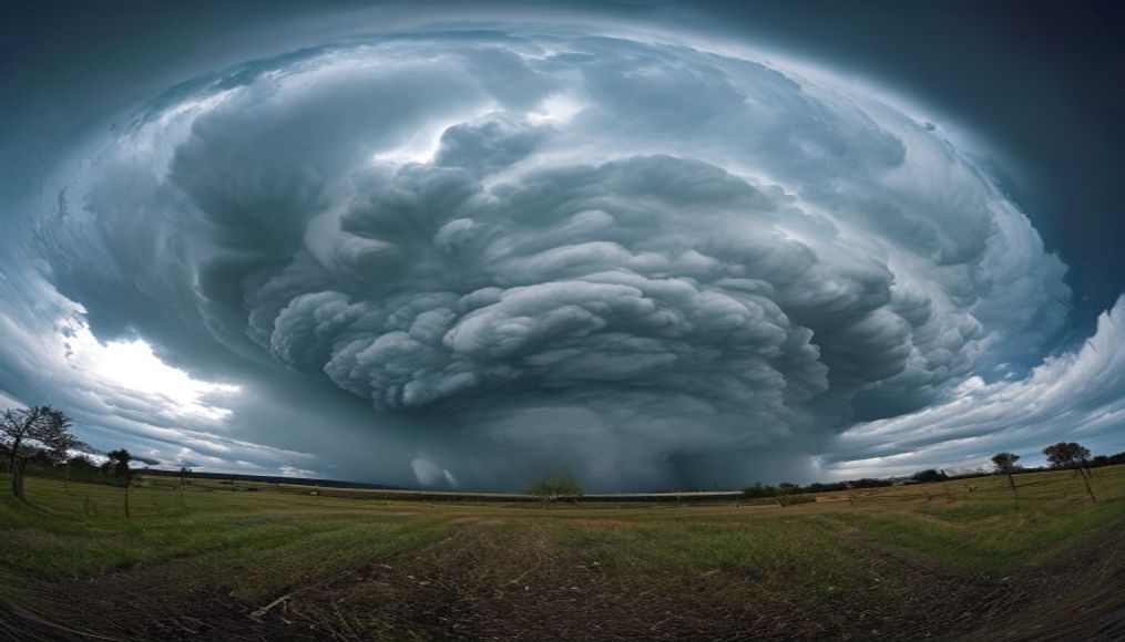
Cumulonimbus thunderhead
1344×768 · AVIF · CC BY 4.0

Cumulonimbus are towering clouds that cause severe storms, lightning, and hail. They can reach the upper troposphere, flattening into an anvil shape.
About this subject
Cumulonimbus are vertically developed clouds associated with intense thunderstorms. They form when warm, moist air rises rapidly in an unstable atmosphere, cooling and condensing. Their base typically lies between 200 and 2,000 meters, while the top can exceed 12,000 meters, reaching the tropopause. At that level, the cloud flattens horizontally into a distinctive anvil shape. Inside, strong updrafts and downdrafts coexist, carrying water droplets, ice crystals, and hailstones.
These clouds are the only ones capable of producing lightning, thunder, hail, and microbursts. Collisions between ice and water particles inside the cloud generate electrical charge separation, leading to lightning discharges. Hail forms when droplets freeze and are repeatedly lifted and dropped, growing in layers. Under extreme conditions, they can spawn tornadoes, especially when associated with supercells.
Cumulonimbus are most common in tropical and temperate regions during spring and summer, but can occur anytime with sufficient heat and moisture. Brazil, due to its extensive territory, frequently sees these clouds, especially in the Amazon, Central-West, and Southeast regions. In São Paulo state, for example, the typical summer thunderstorms are caused by cumulonimbus that develop rapidly in the late afternoon.
Observing cumulonimbus is crucial for weather forecasting and aviation. Pilots avoid flying inside or near these clouds due to severe turbulence, icing, and lightning risk. Meteorologists use radar and satellites to monitor them, as they indicate potentially dangerous storms. Despite their dramatic beauty, cumulonimbus represent one of the most powerful and destructive atmospheric phenomena.
Frequently Asked Questions
What is the difference between cumulonimbus and cumulus?
Cumulus clouds have moderate vertical development and are usually associated with fair weather. Cumulonimbus are much taller (up to 15 km) and produce thunderstorms with lightning, hail, and heavy rain.
How can I identify a cumulonimbus cloud?
Look for a cloud with a high, flattened anvil-shaped top, a dark flat base, and often accompanied by visible precipitation. Internal lightning flashes are also a clue.
What are the dangers of flying near a cumulonimbus?
Severe turbulence, icing, lightning, hail, and strong downdrafts (microbursts) can damage aircraft and compromise safety. Therefore, pilots avoid these clouds.
Direct URL
https://pub-c7d6a6ea828543ac903a74a341ccb2e1.r2.dev/imagens/cumulonimbus-thunderhead-long-exposure-p2.avifHow to credit
Include a visible link back to UtilizAí. Copy one of the snippets below:
<a href="https://xn--utiliza-eza.com/en/midia/imagens/cumulonimbus-thunderhead-long-exposure-p2">Cumulonimbus thunderhead</a> by <a href="https://xn--utiliza-eza.com">UtilizAí</a>, licensed under <a href="https://creativecommons.org/licenses/by/4.0/">CC BY 4.0</a>.
[Cumulonimbus thunderhead](https://xn--utiliza-eza.com/en/midia/imagens/cumulonimbus-thunderhead-long-exposure-p2) by [UtilizAí](https://xn--utiliza-eza.com), CC BY 4.0
License: CC-BY-4.0