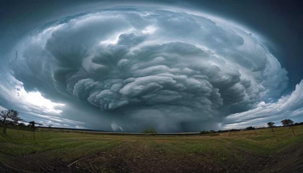
Cumulonimbus thunderhead
1344×768 · AVIF · CC BY 4.0

Cumulonimbus thunderhead is the most imposing storm cloud, capable of reaching the tropopause and generating lightning, hail and tornadoes.
About this subject
Cumulonimbus thunderhead, also known as a storm cloud, is an extreme vertically developed cloud with a base between 200 and 2000 meters altitude and a top that can exceed 16 kilometers, reaching the tropopause. Its characteristic anvil shape at the top, called incus, forms when the updraft hits the stable stratosphere and spreads horizontally. This cloud is responsible for severe weather phenomena such as thunderstorms, hail, torrential rain, strong winds, and in extreme cases, tornadoes.
Formation of a cumulonimbus occurs in environments with warm, moist air near the surface, strong atmospheric instability, and a lifting mechanism such as a cold front, sea breeze, or terrain. The rising air cools adiabatically, condensing water vapor into droplets that release latent heat, further accelerating ascent. This feedback loop drives the cloud's vertical growth, which can develop from a small cumulus into a towering thunderhead in under an hour.
Culturally, the cumulonimbus is a symbol of nature's power, often portrayed in art and photography to represent the raw force of weather. Scientifically, its study is critical for severe weather forecasting and understanding the global hydrological cycle. Weather satellites and radar monitor these clouds to issue storm warnings, protecting populations and infrastructure.
Interestingly, the interior of a cumulonimbus hosts intense updrafts and downdrafts, along with electrical discharges that can heat the air to 30,000°C. Depending on development stage, the cloud is classified as Cumulonimbus calvus (rounded top, no anvil), capillatus (fibrous top), and incus (with anvil). The presence of hail indicates strong updrafts that keep ice particles suspended until they grow large enough to fall.
Frequently Asked Questions
What distinguishes a Cumulonimbus from other clouds?
Cumulonimbus stands out by its extreme vertical development, reaching the tropopause, and its anvil-shaped top. It is the only cloud capable of producing severe storms with lightning, hail, and tornadoes.
How does a Cumulonimbus thunderhead form?
Formation requires warm, moist air, atmospheric instability, and a lifting mechanism like a cold front or terrain. Air rises, condenses, and releases latent heat, accelerating vertical growth until the anvil forms.
What are the dangers associated with these clouds?
Cumulonimbus can produce lightning, large hail, heavy rain causing floods, strong winds, and tornadoes. They also pose hazards to aviation due to severe turbulence and icing.
Direct URL
https://pub-c7d6a6ea828543ac903a74a341ccb2e1.r2.dev/imagens/cumulonimbus-thunderhead-studio-still-life-p1.avifHow to credit
Include a visible link back to UtilizAí. Copy one of the snippets below:
<a href="https://xn--utiliza-eza.com/en/midia/imagens/cumulonimbus-thunderhead-studio-still-life-p1">Cumulonimbus thunderhead</a> by <a href="https://xn--utiliza-eza.com">UtilizAí</a>, licensed under <a href="https://creativecommons.org/licenses/by/4.0/">CC BY 4.0</a>.
[Cumulonimbus thunderhead](https://xn--utiliza-eza.com/en/midia/imagens/cumulonimbus-thunderhead-studio-still-life-p1) by [UtilizAí](https://xn--utiliza-eza.com), CC BY 4.0
License: CC-BY-4.0