Sahara desert dunes pattern
1344×768 · AVIF · CC BY 4.0
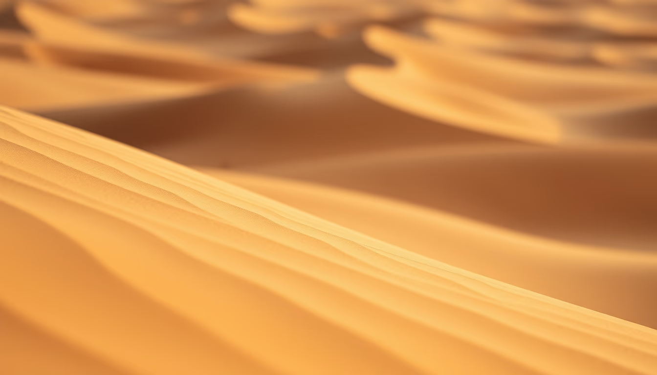
The Sahara desert dunes pattern in macro view showcases the wind-driven forces shaping Earth's largest hot desert.
About this subject
Sahara dunes, covering 3.6 million square miles, form Earth's largest hot desert through aeolian processes. These dunes migrate 10-20 meters annually as winds sculpt crescent-shaped barchan dunes. Macro photography reveals sedimentary layers and granular textures shaped by over 300 days of annual sunshine. The Ténéré region, dubbed 'the desert of deserts', holds 90% of the Sahara's dune fields. Notably, the Tibesti Mountains in Chad host Emi Koussi (3,415m), the desert's highest peak, whose name translates to 'stone in the desert' in Tuareg language.
Frequently Asked Questions
How do Sahara dunes form?
They're shaped by winds carrying sand particles (0.1-0.5mm) from eroded granitic and basaltic rocks, creating geometric patterns through deposition and erosion processes.
What's the migration speed of these dunes?
Barchan dunes move 10-20 meters/year, while linear dunes can migrate up to 100 meters/year depending on wind intensity and direction.
Are there ancient riverbeds beneath the desert?
Yes, fossilized river channels up to 100 km long were discovered under the dunes, proving the Sahara was a wet savanna landscape 5,000-10,000 years ago.
Direct URL
https://pub-c7d6a6ea828543ac903a74a341ccb2e1.r2.dev/imagens/sahara-desert-dunes-pattern-macro-closeup-v5.avifHow to credit
Include a visible link back to UtilizAí. Copy one of the snippets below:
<a href="https://xn--utiliza-eza.com/en/midia/imagens/sahara-desert-dunes-pattern-macro-closeup-v5">Sahara desert dunes pattern</a> by <a href="https://xn--utiliza-eza.com">UtilizAí</a>, licensed under <a href="https://creativecommons.org/licenses/by/4.0/">CC BY 4.0</a>.
[Sahara desert dunes pattern](https://xn--utiliza-eza.com/en/midia/imagens/sahara-desert-dunes-pattern-macro-closeup-v5) by [UtilizAí](https://xn--utiliza-eza.com), CC BY 4.0
License: CC-BY-4.0