Norwegian fjord aerial view
1344×768 · AVIF · CC BY 4.0
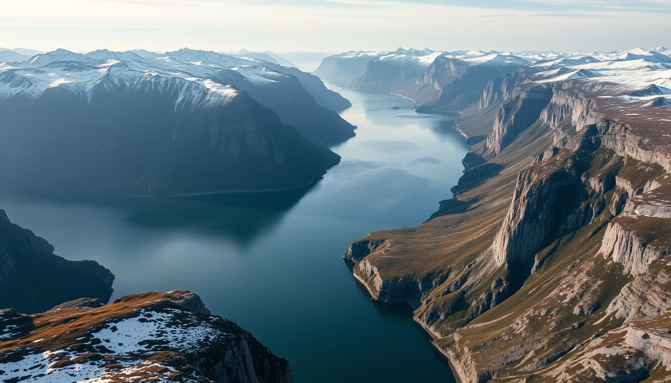
Breathtaking aerial view of a Norwegian fjord, unveiling the natural majesty sculpted by ice.
About this subject
Norwegian fjords are a natural wonder formed during the last ice age. They are the result of glacial erosion that carved out steep and deep valleys, later flooded by the sea. This aerial image captures the serene and imposing essence of these fjords, with their crystal-clear waters and abrupt mountains. Norway is home to over 1,700 fjords, each unique in its formation and beauty. The longest and deepest fjord in the country is the Sognefjord, measuring 204 km in length and 1,308 meters in depth.
Frequently Asked Questions
What are fjords?
Fjords are narrow and deep valleys formed by glacial erosion and later flooded by the sea.
How many fjords are there in Norway?
Norway is home to over 1,700 fjords.
What is the longest and deepest fjord in Norway?
The Sognefjord is the longest and deepest fjord in Norway, measuring 204 km in length and 1,308 meters in depth.
Direct URL
https://pub-c7d6a6ea828543ac903a74a341ccb2e1.r2.dev/imagens/norwegian-fjord-aerial-view-minimalist-composition-v6.avifHow to credit
Include a visible link back to UtilizAí. Copy one of the snippets below:
<a href="https://xn--utiliza-eza.com/en/midia/imagens/norwegian-fjord-aerial-view-minimalist-composition-v6">Norwegian fjord aerial view</a> by <a href="https://xn--utiliza-eza.com">UtilizAí</a>, licensed under <a href="https://creativecommons.org/licenses/by/4.0/">CC BY 4.0</a>.
[Norwegian fjord aerial view](https://xn--utiliza-eza.com/en/midia/imagens/norwegian-fjord-aerial-view-minimalist-composition-v6) by [UtilizAí](https://xn--utiliza-eza.com), CC BY 4.0
License: CC-BY-4.0