Eyjafjallajökull volcano
1344×768 · AVIF · CC BY 4.0
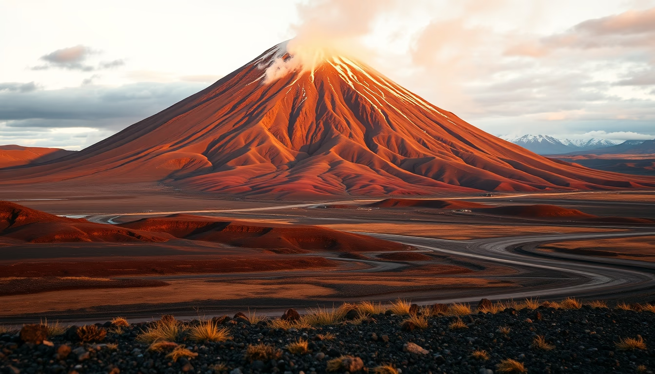
Eyjafjallajökull volcano in Iceland became world-famous after its 2010 eruption, which paralyzed European air traffic.
About this subject
Eyjafjallajökull is a subglacial volcano located in southern Iceland, beneath an ice cap of the same name. Its name translates to "glacier of the mountain islands" in Icelandic. The volcano stands approximately 1,666 meters tall, with a summit crater 2.5 km in diameter, filled with ice. The last major eruption occurred from March to October 2010, with an explosiveness that generated a volcanic ash plume up to 11 km high. This plume was carried by winds across Europe, leading to the closure of airspace in several countries and affecting about 10 million passengers.
Seismic activity preceded the eruption, with thousands of small earthquakes recorded in the weeks prior. The eruption occurred in two phases: a less violent one on March 20, and a more explosive one on April 14, which produced the ash cloud. The interaction of magma with glacial ice caused phreatic explosions, fragmenting the magma into fine particles. Later studies indicated that the magma composition was trachyte and dacite, with high silica content, contributing to viscosity and explosiveness.
Culturally, the name Eyjafjallajökull became a pronunciation challenge for non-Icelandic speakers. After the eruption, tourism in the region increased significantly, with visitors eager to see the volcano and the altered landscape. The glacier covers an area of about 100 km² and feeds several rivers and waterfalls, such as the famous Skógafoss. The volcano is part of the North Atlantic Volcanic Belt, resulting from the separation of the North American and Eurasian tectonic plates.
Scientifically, the 2010 eruption was an important event for studying volcanic plumes and their effects on aviation. Ash dispersion models were improved based on collected data. Additionally, the event highlighted the need for continuous monitoring of subglacial volcanoes, which can pose significant risks. Iceland has about 30 active volcanic systems, and Eyjafjallajökull is closely monitored by seismometers and GPS.
Frequently Asked Questions
What caused the 2010 eruption of Eyjafjallajökull?
The eruption was caused by ascending magma beneath the glacier, combined with interaction between magma and ice generating phreatic explosions. Increasing seismic activity in preceding weeks indicated rising magmatic pressure.
What was the impact of the 2010 eruption on air traffic?
The volcanic ash cloud forced the closure of airspace over much of Europe for several days, canceling over 100,000 flights and affecting millions of passengers. It was the largest disruption of commercial aviation since World War II.
Is it safe to visit Eyjafjallajökull now?
Yes, the volcano has been dormant since 2010. The area is a popular tourist attraction with trails and viewpoints. However, it is important to check alerts from the Icelandic Meteorological Office, as the area may pose risks such as sudden weather changes or seismic activity.
Direct URL
https://pub-c7d6a6ea828543ac903a74a341ccb2e1.r2.dev/imagens/eyjafjallajokull-volcano-travel-photography-p4.avifHow to credit
Include a visible link back to UtilizAí. Copy one of the snippets below:
<a href="https://xn--utiliza-eza.com/en/midia/imagens/eyjafjallajokull-volcano-travel-photography-p4">Eyjafjallajökull volcano</a> by <a href="https://xn--utiliza-eza.com">UtilizAí</a>, licensed under <a href="https://creativecommons.org/licenses/by/4.0/">CC BY 4.0</a>.
[Eyjafjallajökull volcano](https://xn--utiliza-eza.com/en/midia/imagens/eyjafjallajokull-volcano-travel-photography-p4) by [UtilizAí](https://xn--utiliza-eza.com), CC BY 4.0
License: CC-BY-4.0